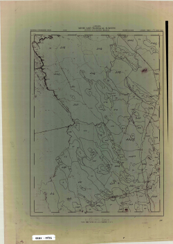
J-28 Rolling Dam-Dumbarton-Clarence Ridge2

Type
Other
Authors
NBDLM ( Department of Lands and Mines - New Brunswick )
Category
Maps
[ Browse Items ]
Publication Year
1952
Subject
Forestry
Description
K.H.D19724 inches = 1 mile30" x 39.5"Rolling Dam- Dumbarton-Clarence RidgeNoVellumMap showing major roads, wetlands, elevations, towns, villages, parishes and counties around Rolling Dam, Dumbarton and Clarance Ridge with outlines of forest management zones
Number of Copies
1
| Library | Accession No | Call No | Copy No | Edition | Location | Availability |
|---|---|---|---|---|---|---|
| SCIWC Outdoor Centre | 12429 | STCRX-0332 | 1 | Yes |


