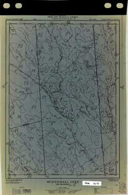
McDougal Lake4

Type
Other
Authors
GOC-DEMR-SMB ( Department of Energy, Mines and Resources Canada - Surveys and Mapping Branch )
Category
Maps
[ Browse Items ]
Subject
Topographic
Description
1:50,00030" x 21"McDougall Lake, New BrunswickYesVellumTopographic map of areas surrouding McDougall Lake showing elevation changes (including contour lines), roads and highways- revisions outline compartments with unknown writing
Number of Copies
1
| Library | Accession No | Call No | Copy No | Edition | Location | Availability |
|---|---|---|---|---|---|---|
| SCIWC Outdoor Centre | 12751 | STCRX-0654 | 1 | Yes |


